Skip to main contentResource added 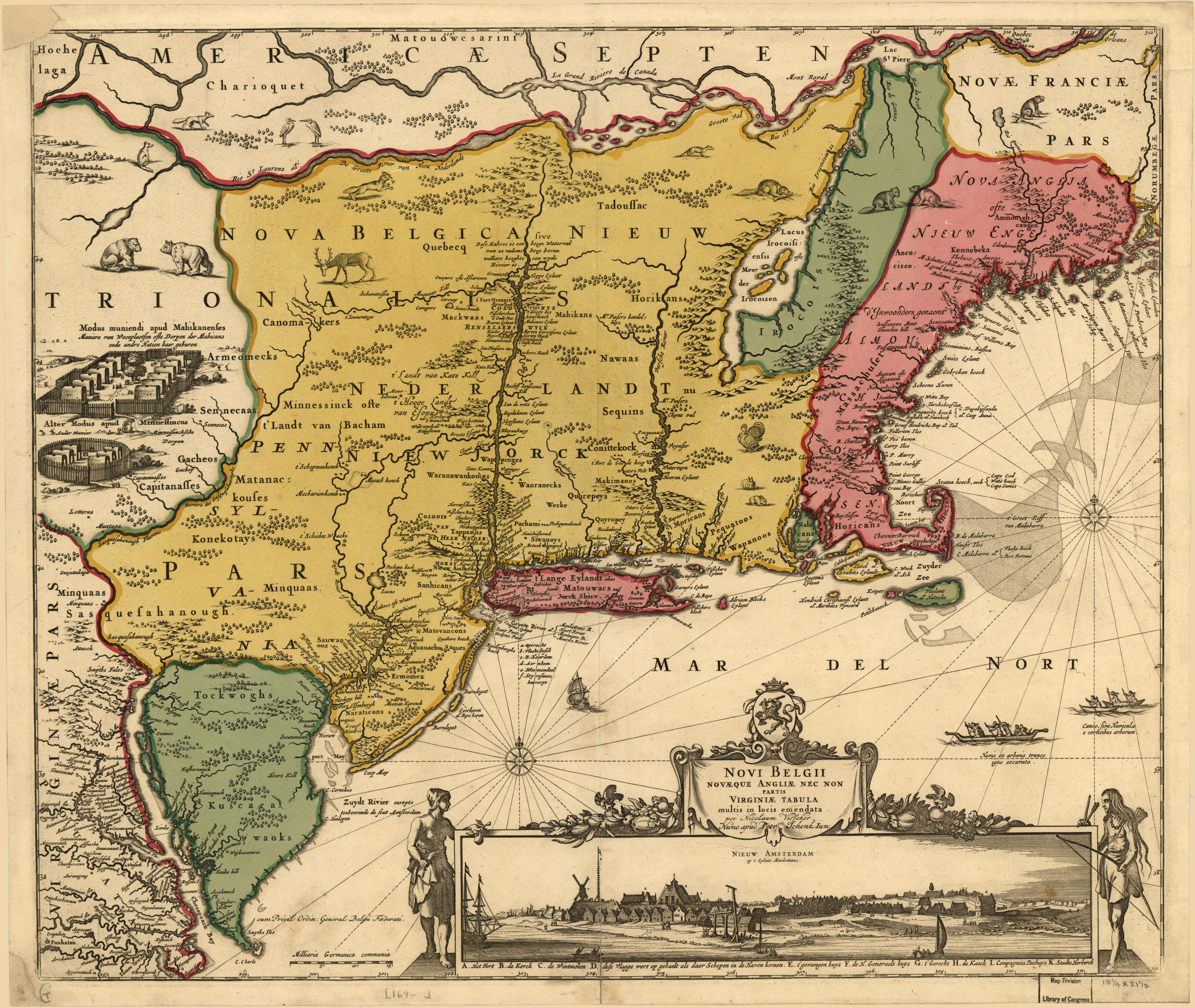

Latin: Novi Belgii Novæque Angliæ nec non partis Virginiæ tabula Map of New Netherland and New England, and also parts of Virginia
Full description
Nicolaes Visscher [Public domain], via Wikimedia Commons Stokes, Iconography, p. 147 (vol. 1), lists dates as 1651-55. See Map collectors circle, #24. Includes view "Nieuw Amsterdam op t eylant Manhattans." Scale: ca. 1:3,300,000 Nicolaes Visscher: Novi Belgii Novæque Angliæ: nec non partis Virginiæ tabula multis in locis emendata / per Nicolaum Visscher nunc apud Petr. Schenk Iun. (1685) Original map in 1656; this is a reprint from 1685 This image is available from the United States Library of Congress's Geography & Map Division under the digital ID g3715.ct000001.
Comments
to view and add comments.
Annotations
No one has annotated a text with this resource yet.
- typeImage
- created on
- file formatjpg
- file size15 MB